Capture in the field. Sync without thinking.
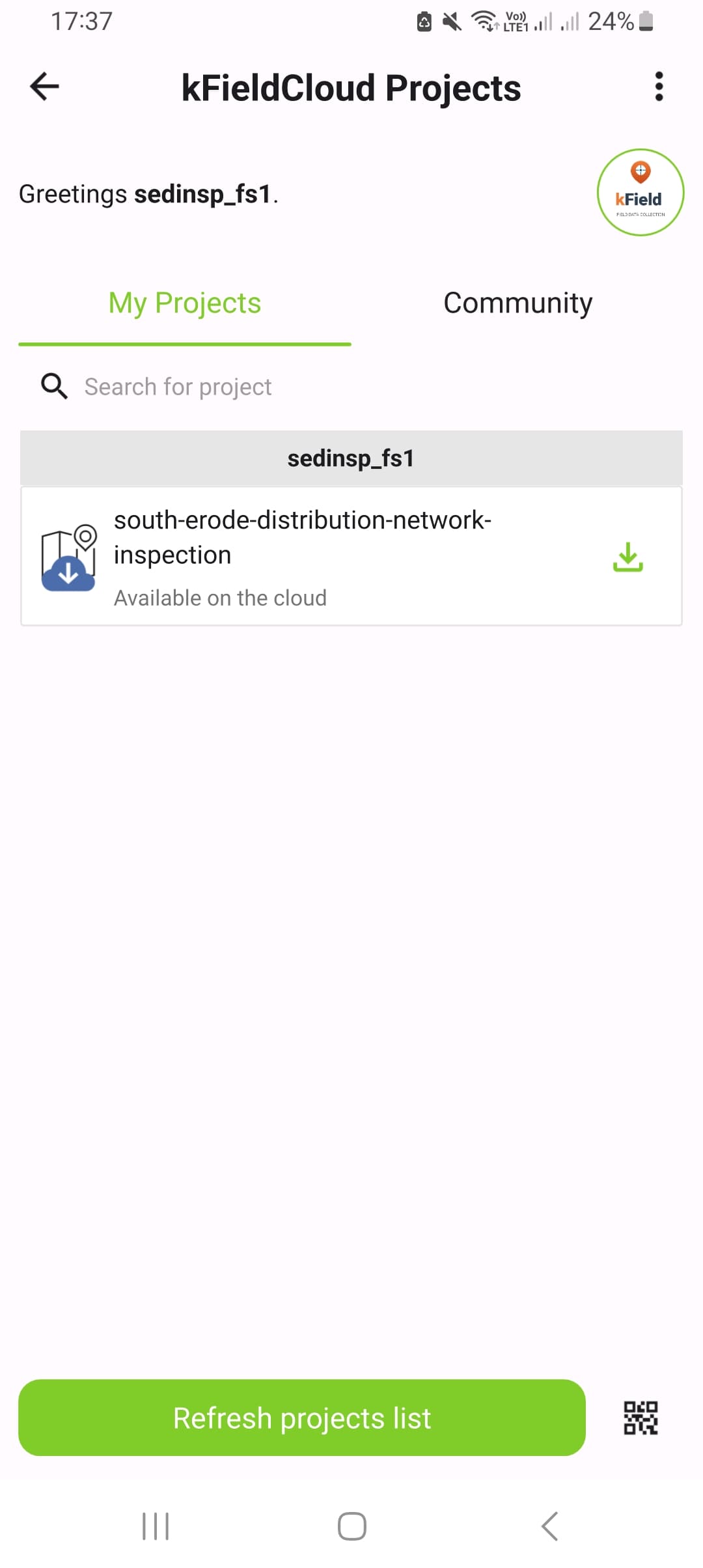
kField is a hosted mobile and cloud platform for geospatial field data. Officers capture offline on Android. The data lands on your dashboard the moment they are back on Wi-Fi. You pay per field officer.
Offline-first
Collect without a signal. Sync when you reconnect.
QGIS-native
Author with the desktop QGIS your team already uses. No new tools to learn.
Per-officer pricing
Predictable billing tied to your active field crew. Scale seats up or down each month.
Enterprise-grade security
Encrypted in transit, role-based access, per-project permissions, audit-ready.
Design once, collect everywhere.
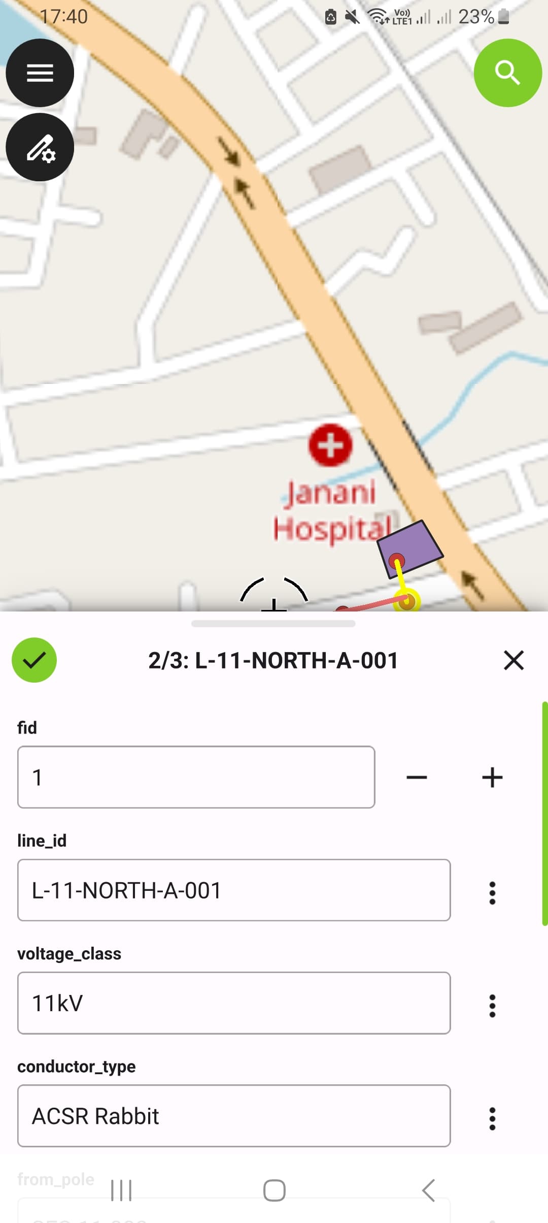
Use the QGIS desktop you already know. Configure forms, attribute constraints, photo-attachment rules, and offline extents. Push the finished project to your kField account in a single click via the free QFieldSync plugin.
Built for the way real field teams work.
kField runs on any modern Android device. Offline-first: capture points, lines, polygons, photos, and audio notes without a signal. Concurrent edits across crew members reconcile cleanly, with no overwrites and no lost data.
The phone catches up the moment it's back on Wi-Fi.
No more reminding officers to tap Sync at the end of the day. kField detects Wi-Fi automatically, and uploads pending captures the instant the device is back in range, even if the app is closed. Edits stay safely local while the officer is in edit mode; the moment they leave, sync fires. Every attempt (successful or failed) is recorded in an in-app history log so you can verify what happened.
Daily activity reports, delivered to your inbox.
Every morning you'll find a one-page summary of what your team did yesterday: features captured, photos uploaded, who was active, which projects were touched. Plus a CSV attachment for your spreadsheet. Configurable per organization. Pick your timezone, your preferred report time, your recipients. Or pull a report on-demand for any past day. Without ever logging into the dashboard.
Per-field-officer pricing. Nothing else to manage.
No servers to provision, no upgrades to schedule, no infrastructure team needed. Add field officers when your project ramps up, scale down between seasons. Annual or monthly billing. Talk to us about volume rates for 50+ seats.
From QGIS desktop to your field crew, in three steps.
We run the backend. You design the projects, we host the data, and your team collects with the kField Android app.
Author in QGIS
Design data models, forms, and offline extents in the desktop QGIS you already use. Free QFieldSync plugin.
Subscribe and provision
Tell us how many field officers you need. We onboard your account, provision seats, and hand over login credentials.
Collect & sync
Crews use the kField Android app to capture features offline. Edits sync to your kField cloud account when they're back online.
Get a quote for your team.
Pricing is per active field officer per month, with volume rates above 50 seats. Tell us your team size, project type, and timeline. We'll send a quote within one business day and schedule a demo.
Or call kCube directly. See contact details on kcubeconsulting.com.